THREE decades ago, Penang was selected to start a state-wide Geographical Information System (GIS) to help support the various functions of the state government, including the city councils (known as municipal councils then), state Valuation and Property Services Department and other relevant bodies.
Datin Dr Kam Suan Pheng, 72, a retired lecturer from Universiti Sains Malaysia (USM), played an instrumental role in the setting up of the Penang GIS, commonly known as PEGIS, in 1992, alongside a group of professionals from the said field.
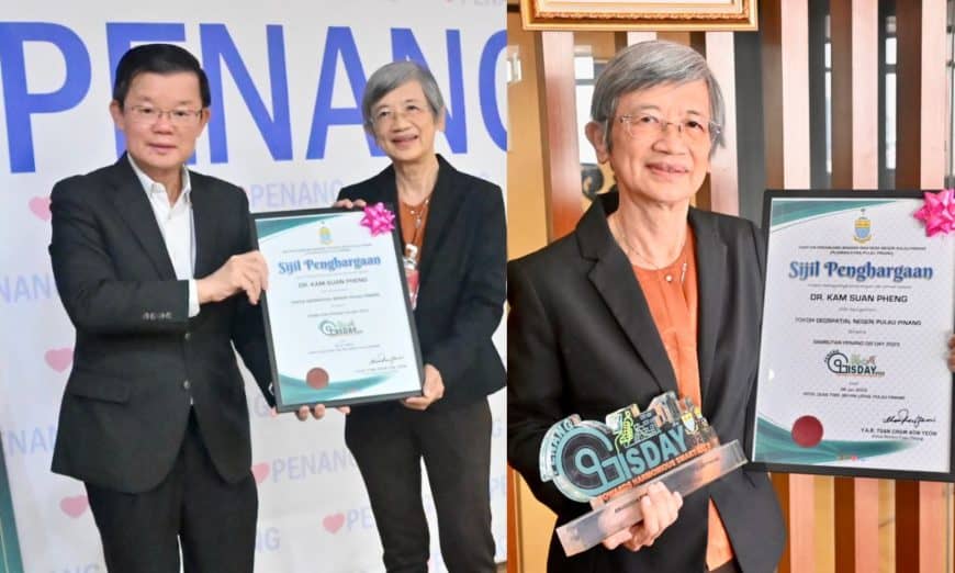
Today, Dr Kam, a retired soil expert and a distnguished scientist, received recognition from the Penang government. She was presented with a certificate of appreciation that now recognises her as the ‘Penang Geospatial Leader’.
The certificate was prepared by the state Town and Country Planning Department (Penang PLANMalaysia) and was presented to Dr Kam by Chief Minister Chow Kon Yeow in Komtar earlier this morning.
During an exclusive interview with Buletin Mutiara, Dr Kam said she was honoured with the award and thanked the state government for recognising her contributions, which came as a pleasant surprise.
“At the time when Penang was chosen to spearhead the centre, I had just started a GIS laboratory at USM following the training I received from the Asian Institute of Technology in Thailand.
“We held a pilot project for the initiative from 1992 to 1994, and although we couldn’t cover the entire state of Penang, we managed to identify several areas, where we worked closely with the various state government departments at the PEGIS centre in Komtar back then.
“We designed various applications that suited the needs of the departments, and more importantly, we had to digitise the data to stay relevant in this modern and digitally advanced era.
“Since this was the first ever in Penang, it attracted a lot of attention from other states, and many visitors came to the laboratory to see how we managed the system.
“It is very important to have this kind of system that integrates information from various departments, and the beauty of the GIS is that it is an integrative tool extensively utilised by relevant departments to ensure seamless coordination across all operations.
“I am really happy that PEGIS is still functioning after all these years, and it gives me greater satisfaction to know that I was a part of this centre during its inception in 1992,” Dr Kam said during the interview in Komtar today.
Dr Kam, who holds a PhD in Agronomy-Soil from Cornell University in New York, boasts an impressive 35 years of experience in research and teaching at institutions such as Universiti Sains Malaysia, the International Rice Research Institute in the Philippines, and the WorldFish Center in Penang.
At the age of 72, Dr Kam is still full of energy and keeps herself busy as she is determined to impart the knowledge and experiences she gained for the betterment of the next generation of Geospatial experts.
She is actively involved in a lot of civil society issues, and just recently, she spent some time overseeing the databases concerning the Local Plan Draft (Penang Island City Council and Seberang Perai City Council).
“For a state like Penang that does planning in a detailed manner, it is important to have accurate databases,” she said.
Story by Kevin Vimal
Pix by Law Suun Ting

